

AERIAL IMAGERY ASSESSMENTS IN THE TIME OF CV-19
We are working remotely using our shared secured cloud drive and continue to deliver Aerial Imagery Assessment.
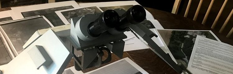
Due to CV-19 restrictions access to the Historic England Air Photo Archive is limited to searches and pre-scanned data, and not available to in-person consultation.
We have adjusted our project specifications and widened our AP source searches to account for this necessary restriction.
APS has approval for this adjustment from the Chartered Institute for Archaeologists (CIfA) and from the Local Authority Archaeologists we have consulted and informed in the course of our 2020 project work.
We will still provide you with our usual service, using some different and extensive sources of historical and modern aerial photos, Lidar data and small-area high-resolution satellite imagery.
Which sources are we still able to use?
In 2021 we use a variety of the following sources to provide comprehensive assessment of aerial imagery assessment.
1. Our own UK-wide project AP archives (1990 – 2020), which include tens of thousands of aerial photographs we have collected from HE throughout England, and our own aerial photos where available
2. Coversearch data from HE, as CSV files in our GIS, to provide data on the location of specialist obliques
3. Pre-scanned images delivered online from HE
4. Online access to small-area high resolution satellite imagery – the choice of sensors, dates and resolutions is excellent – and other public and commercial sources such as European Space Imaging
5. Historic and modern aerial photographs available online from a range of commercial providers
6. APGB georeferenced aerial imagery via DEFRA where available
7. APs in Historic Environment Records (HERs) and Records Offices/History Centres where available online or via Local Authority departments
8. All timelines at Google Earth, often from 1945 – 2021
9. Bing Maps, and Bing Birdseye imagery
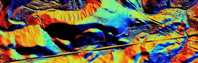
10. Visualised open source Environment Agency (EA) and NLP Lidar data
11. Britain From Above – the Aerofilms online database
12. National Collection of Aerial Photography (NCAP)
13. The CUCAP online database and some digitised images which are displayed online
14. HE National Mapping Programme (NMP and AIM) data directly from some external providers – previous and recent archaeological mapping from airborne remote sensing data
15. Commercial AP searching agencies
16. Geology, soil, historic and modern mapping sources available online, to augment and inform our assessment
Chris Cox
Air Photo Services Ltd
March 2021

