FRIENDLY SERVICE, EXCEPTIONAL CLIENT CARE AND VALUABLE ADVICE
our Team
_____________________________________________________________________________________________________
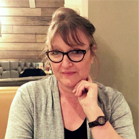
Chris Cox MCIfA FSA
Director
chris.cox@airphotoservices.co.uk
+44 (0) 7827 810 361
Chris is a professional heritage consultant, specialist interpreter of aerial imagery and Lidar data and an experienced expert witness.
She advises clients on major infrastructure, renewable energy, legal and commercial development projects throughout the UK, Europe and Middle East. She has over 32 years of experience as an interpreter of aerial imagery in the planning, heritage, environmental and engineering sectors, and experience in the provision of professional development training, recruitment and mentoring of graduate level staff.
Chris is responsible for our business development, tendering and consultancy advice. She works with an extensive client base which encompasses legal, planning and heritage professionals, large multi-disciplinary consultancies, major property developers and consultancy groups responsible for large infrastructure and residential development projects in the UK.
Chris is a member of, and National Vocational Qualification assessor for, the Chartered Institute for Archaeologists, a member of the Society of Expert Witnesses, the Aerial Archaeology Research Group and fellow of the Society of Antiquaries of London.
_____________________________________________________________________________________________________
Nereide Gilhead ACCA
PA to the Director
nereide.gilhead@airphotoservices.co.uk
+44 (0) 7903 569 675
After a successful career in Europe and the USA, Nereide sold her London restaurant to become a Head Clark of Chambers to a set in Gray’s Inn Square. After her marriage she started her own specialist conservation company restoring porcelain. When this market was impacted by the financial crash, she went back to college and took a diploma in Business Studies.
She then worked as Head of Administration organising international trade exhibitions for a furnishing fabric business. From there she moved to become Team Administrator for the Archaeological Offices of Waterman PLC, and later Head of Accounts Payable for Waterman Civil Engineering based in The City.
Nereide brings to Air Photo Services a wide range of relevant experience in specialist archaeological work informing civil engineering projects and SME operations, and provides sound financial and quality assurance overview of our major projects
_____________________________________________________________________________________________________
David Lang BA CELTA PCIfA
Associate Director
david.lang@airphotoservices.co.uk
+60 (0) 197065983
David has worked with Air Photo Services as an Associate since 2013, and in September 2020 took up a Directorship to work alongside Chris Cox.
A graduate of the University of Bradford, David has worked with us on major infrastructure projects, providing air photo interpretation, technical development evaluations, project management and professional development training expertise.
His fieldwork and aerial survey experience has taken him to multi-period sites and infrastructure development schemes throughout the UK, Europe and Armenia, prior to pursuing a career in Sri Lanka and Malaysia with the British Council between 2015 and 2020.
As our Associate Director, David provides business and professional development support, working within our UK heritage infrastructure projects to promote our use of satellite imagery and remote sensing data and assist our team to develop new products and working practices for our immediate future and into 2021.
He is also developing our online commercial CPD courses for established heritage professionals and early career archaeologists, as we transfer our training provision from an in-person group environment to a dynamic online platform.
_____________________________________________________________________________________________________
Adam Jarvis ACIfA
Geomatics Technician
adam.jarvis@airphotoservices.co.uk
+44 (0) 7951 052 212
Adam is an innovative Geomatics professional with over 10 years’ experience in GIS design, technical GIS development and data management, illustrative interpretation and mapping in the heritage sector.
Adam’s work encompasses the interpretation of aerial photographs, satellite imagery, multi spectral and Lidar data processing and visualisation, and its management and analysis within a GIS environment. He provides technical lead on our bespoke GIS strategies and attribute tables for our major infrastructure EIA projects, technical contribution to our training courses, and internal teaching materials to assist our continuing professional development and learning in this swiftly developing discipline which is essential to our client work. He is responsible for our database design in MS Access and Excel, in addition to our Social Media strategy and marketing, website maintenance and design and development of logos, marketing material and report formats. In 2018, he began compiling his portfolio for award of the CIfA level 3 NVQ in Archaeological practice, including his innovative work on our HS2 remote sensing GIS databases and mapbooks, for Chris to assess. We look forward to his gaining this award in 2020.
________________________________________________________________________________________________
Rog Palmer MA MCIfA
Associate
rog.palmer@ntlworld.com
+44 (0) 1223 572063
Rog is a specialist interpreter of aerial imagery and Lidar data, who has worked with aerial photographs since the mid-1960s following an aircraft engineering apprenticeship at RAE in Farnborough. Rog and Chris established Air Photo Services in Cambridge in 1990 to provide heritage assessments from aerial photos under the then recently incepted PPG16 planning guidance, and provides detailed archaeological interpretation from aerial imagery, accurate mapping and reporting for commercial and research projects in the planning and environmental sectors under the present requirements of the NPPF. Rog has published extensively on all aspects of aerial archaeology, and is the Editor of the newsletter of the Aerial Archaeology Research Group. He has established extensive training courses and aerial archaeological projects throughout Europe, Armenia and the Baltic states, and provides bespoke tuition to our trainee aerial imagery analysts.
Past archaeological research projects resulting in major publications covered the Danebury environs and the East Anglian Fenland. In 1976, Rog wrote the first computer program to graphically transcribe information from aerial photographs for archaeologists and, since 1990, has been a beta tester for the specialist program, AirPhoto, written by Irwin Scollar. Rog’s additional research concentrates on theory and methods for the archaeological uses of aerial photographs and satellite images, including extensive publications in peer-reviewed books and specialist journals.